Top Highlights
-
Advanced Monitoring: NISAR, launched to a 747 km orbit, employs dual radar instruments to track Earth’s forest and wetland changes, monitor frozen surface movements, and detect land shifts crucial for understanding natural disasters.
-
Innovative Collaboration: This mission marks a first joint effort between NASA and ISRO, combining their expertise to enhance Earth observations with L-band (sensitive to soil moisture and forest biomass) and S-band radar (focused on agriculture and infrastructure).
-
Cloud and Weather Resilience: Unlike optical sensors, NISAR’s radar technology allows for continuous monitoring of Earth’s surface, even in adverse weather conditions or darkness, enhancing data reliability for disaster preparedness.
-
Localized Impact, Global Data: NISAR’s comprehensive data collection is poised to provide vital insights for communities worldwide, supporting future resilience planning in the face of environmental changes and natural disasters.
NASA-ISRO Satellite Lifts Off to Track Earth’s Changing Surfaces
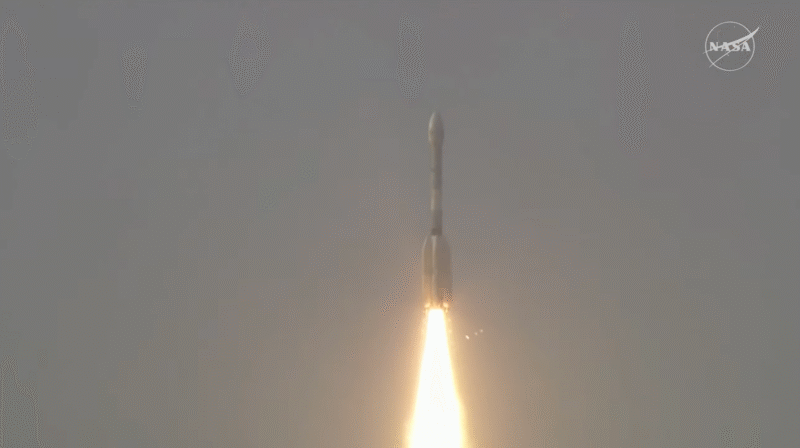
In a significant advancement for Earth observation, NASA and ISRO launched the NISAR satellite successfully. The spacecraft lifted off from India and now orbits 464 miles (747 kilometers) above the planet. Notably, this mission marks the first collaboration in developing hardware for Earth observation between the two space agencies.
NISAR will utilize two state-of-the-art radar systems to monitor and analyze Earth’s dynamic surfaces. The mission will keep track of forests, wetlands, and even the movement of ice and land. This capability hinges on the satellite’s ability to detect shifts down to mere fractions of an inch. Such precision is crucial for understanding geological events like earthquakes and landslides.
“ISRO’s GSLV has precisely injected NISAR into orbit,” said ISRO Chairman V. Narayanan. He expressed confidence that this launch fulfills the scientific vision conceived over a decade ago. With NISAR’s technological prowess, scientists will gain deeper insights into how Earth’s ecosystems evolve.
The two radar instruments — an L-band and an S-band system — work together seamlessly. While the L-band specializes in assessing soil moisture and forest biomass, the S-band excels in monitoring agricultural areas and infrastructure movement. This dual capability sets NISAR apart from previous radar missions.
One of the satellite’s standout features is its ability to penetrate clouds. This functionality allows NISAR to collect valuable data regardless of weather conditions or time of day. “NISAR brings a new way of seeing our planet,” said Karen St. Germain, director of NASA’s Earth Science division. “The data will help us anticipate natural disasters and monitor changes that affect lives.”
In the coming weeks, NISAR will undergo a 90-day commissioning phase. During this time, it will deploy its 39-foot (12-meter) radar antenna, crucial for gathering data. Scientists aim to evaluate how the surface changes over time, providing vital information for communities worldwide.
This mission is a landmark achievement in international collaboration. NASA’s Jet Propulsion Laboratory (JPL) led the U.S. efforts, while ISRO’s Space Applications Centre developed the S-band radar. Both agencies worked hand in hand, integrating their expertise for a common goal.
“People everywhere will benefit from NISAR’s data,” said Dave Gallagher, director of NASA JPL. “This mission will facilitate planning for a resilient future.” As new technologies continue to emerge, NISAR stands as a beacon of progress in scientific research and a tool for enhancing quality of life on Earth.
For more information about NISAR, visit Nisar JPL.
Continue Your Tech Journey
Learn how the Internet of Things (IoT) is transforming everyday life.
Access comprehensive resources on technology by visiting Wikipedia.
SciV1

