Top Highlights
-
Local Wind Data Collection: NASA’s advancements allow for localized wind data collection, significantly improving wildland fire decision-making and resource allocation for firefighting.
-
Innovative Technology Use: The Alta X drone, equipped with 3D wind sensors and radiosondes, is utilized to gather critical atmospheric data during prescribed burns in Alabama, enhancing understanding of smoke dispersion and humidity levels.
-
Multi-Agency Collaboration: The FireSense project involves multiple agencies, aiming to test and validate new technologies to support the U.S. Forest Service and other fire management organizations in improving burn forecasts.
- Impactful Data Insights: The research aims to provide valuable insights into the mixing height and moisture changes throughout the day, aiding in more accurate predictions of fire behavior and smoke impacts for future operations.
NASA recently launched an initiative to enhance wildland fire management through advanced technology. The agency’s Armstrong Flight Research Center in California is testing innovations that could transform how firefighting agencies address wildfires.
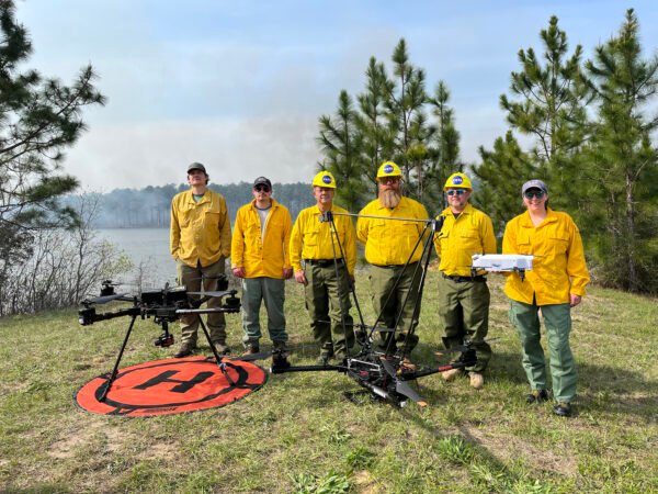
For example, NASA equipped its Alta X drone with two instruments from the Langley Research Center. One sensor captures three-dimensional wind data, while a radiosonde measures temperature, pressure, and humidity levels. Researchers deployed this technology during a prescribed burn in Geneva State Forest, located about 100 miles south of Montgomery, Alabama. This event is part of NASA’s ongoing FireSense project, which seeks to provide valuable data to the U.S. Forest Service and other firefighting agencies.
The information gathered during the burn is critical. It helps experts predict smoke dispersion, a challenging variable to quantify. To effectively conduct a prescribed burn, humidity must stay above 30%. Current methods often lack local data collection tools, making the Alta X’s technology invaluable for ensuring safer and more effective burns.
Additionally, NASA will deploy its B200 King Air to monitor active fires from an altitude of 6,500 feet. Other sensors will gather information at varying altitudes before, during, and after the burn. This comprehensive approach aims to refine the predictive models used in wildfire management.
The team preparing for the Alabama flights consists of experienced pilots and engineers from NASA Armstrong. They will oversee the launch and recovery of the Alta X, which operates autonomously for accurate data collection throughout the day.
Earlier this year, NASA conducted a similar demonstration in Missoula, Montana, showcasing the potential of drone technology to forecast localized weather patterns. These advancements not only improve fire management but also enhance the overall safety and effectiveness of firefighting operations.
The integration of NASA’s technology into wildland fire management promises to yield significant benefits for communities prone to wildfires. As organizations adopt these innovations, they can improve readiness, reduce risks, and ultimately save lives.
Discover More Technology Insights
Dive deeper into the world of Cryptocurrency and its impact on global finance.
Explore past and present digital transformations on the Internet Archive.
SciV1

