Quick Takeaways
-
Firefighting Efficiency: The Fire 2400 nm Quicklook, favored by Alabama Forestry Commission crews, helped them visualize wildfire outlines, guiding bulldozer deployment to effectively halt fire spread.
-
Real-time Intelligence: FireSense personnel utilized AVIRIS-3 imagery to create rapid, digitized fire perimeters, offering firefighters critical insights for tactical decision-making, particularly in high-pressure situations like the Castleberry Fire.
-
Resource Allocation: Intelligence from AVIRIS-3 allowed forestry officials to reallocate resources in response to evolving fire threats, focusing efforts on hot spots while ensuring buildings’ safety during the containment process.
- Advanced Technology in Fire Management: NASA’s AVIRIS and FireSense Airborne Campaigns exemplify the integration of advanced technologies in wildfire management, enhancing responsiveness and coordination in emergency airspace operations for firefighting efforts.
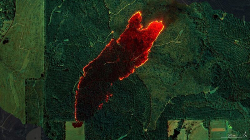
NASA has launched a mission to assist firefighters with advanced technology. Firefighters now use data from NASA’s airborne sensor, specifically the 2400 nm Quicklook, to enhance their wildfire response. The tool quickly identifies the outline of a wildfire from the air.
For example, during the Castleberry Fire, this aerial view enabled Alabama firefighters to pinpoint the most intense areas. As a result, they focused their containment efforts effectively, especially on the northeastern edge where conditions were critical.
Additionally, FireSense personnel analyzed imagery from the AVIRIS-3 sensor. They created detailed, digitized fire perimeters, delivering fast and clear intelligence to firefighting crews. This data proved crucial. When another fire threatened buildings near Perdido, the firefighters detected that the primary hot spot was inside the containment area. This critical insight allowed them to redirect resources to a more pressing fire 25 miles away in Mount Vernon.
At Mount Vernon, firefighting crews utilized AVIRIS-3 maps to strategize fire breaks. This planning helped them contain the flames to within 100 feet of four buildings. “Fire moves a lot faster than a bulldozer, so we have to get around it before it overtakes us,” one fire analyst explained. The maps provide the necessary insights to stay ahead of the flames.
NASA’s efforts extend beyond immediate fire response. The agency showcases how technology can play a vital role in wildfire management. Their Advanced Capabilities for Emergency Response Operations project focuses on improving airspace management for drones battling wildfires. With these innovations, NASA not only aids firefighters but also enhances safety in increasingly volatile wildfire conditions.
Continue Your Tech Journey
Dive deeper into the world of Cryptocurrency and its impact on global finance.
Access comprehensive resources on technology by visiting Wikipedia.
SciV1

